Land Records and GIS Cadastral Systems help governments, land agencies, municipalities, survey departments, planning authorities, utilities, real estate institutions, and public-sector organizations manage land ownership, parcel boundaries, property rights, mutations, survey records, land use, valuation layers, encumbrances, and spatial maps in one connected system. These platforms combine legal land records with GIS-based parcel mapping so decision-makers can understand not only who owns or uses land, but also where each parcel is located, how boundaries connect, and how land information changes over time.
A strong cadastral system improves transparency, reduces land disputes, supports taxation and planning, improves public access to land information, and helps agencies maintain accurate parcel data. ArcGIS Parcel Fabric, for example, is positioned as GIS-enabled parcel management software for mapping, maintaining, and accessing land records across an organization, while Trimble’s fit-for-purpose land administration approach focuses on capturing land rights and parcels efficiently using geospatial tools.
Why It Matters
Land administration is one of the most important foundations for governance, infrastructure planning, property taxation, real estate development, environmental regulation, and citizen services. When land records and cadastral maps are disconnected, agencies face duplicate records, boundary mismatches, ownership disputes, slow mutation workflows, poor valuation accuracy, and low public trust. A modern land records and GIS cadastral platform connects ownership data with spatial parcel data, survey workflows, document history, maps, and public-facing services. Some systems also support advanced parcel history, where legal records and parcel changes can be preserved over time instead of only showing a current snapshot.
Real-World Use Cases
- Revenue departments managing ownership records, mutations, and land registers
- Survey agencies maintaining parcel boundaries and cadastral maps
- Municipalities linking property tax records with parcel maps
- Planning departments analyzing land use, zoning, easements, and restrictions
- Courts and dispute-resolution teams reviewing boundary and title conflicts
- Utilities identifying land parcels for infrastructure planning and right-of-way work
- Real estate agencies validating parcel status and ownership information
- Public portals giving citizens access to land records, maps, and mutation services
- Government modernization teams digitizing legacy paper records and maps
- Environmental agencies linking land parcels with protected zones and risk layers
Evaluation Criteria for Buyers
- Parcel fabric and cadastral map management
- Land ownership and title record support
- Mutation and transfer workflow handling
- Survey and boundary editing tools
- GIS visualization and spatial analysis
- Integration with registration, taxation, planning, and court systems
- Public portal and citizen-service support
- Historical parcel tracking
- Document management for deeds, maps, survey files, and certificates
- Role-based access and audit trails
- Mobile survey and field data collection
- Data migration from legacy maps and paper records
- Cloud, on-premises, or hybrid deployment flexibility
- Reporting and dashboard capabilities
Best for: Land revenue departments, cadastral agencies, municipalities, survey offices, land registries, planning authorities, infrastructure agencies, and public-sector digital land modernization programs.
Not ideal for: Small private teams that only need simple property lists, basic mapping, or generic document storage without cadastral editing, parcel history, legal record linkage, or government workflow needs.
Key Trends in Land Records and GIS Cadastral Systems
- Parcel fabric modernization: Agencies are moving from static parcel maps to structured parcel fabrics that preserve relationships, boundaries, and legal history.
- Integrated land records: Ownership data, parcel maps, registration records, tax records, and planning layers are being connected into unified land information systems.
- Citizen-facing portals: Governments are offering online land record search, map viewing, mutation tracking, and certificate access.
- Fit-for-purpose land administration: Some land programs are using practical, scalable approaches to capture rights and parcels faster, especially where formal documentation is incomplete.
- Mobile field surveying: GNSS-enabled mobile tools are making boundary capture, parcel verification, and field inspections more efficient.
- Historical parcel tracking: Modern cadastral platforms increasingly preserve the history of parcel splits, merges, subdivisions, and legal changes.
- Interdepartmental data sharing: Revenue, registration, planning, taxation, courts, utilities, and urban development teams need shared land information.
- 3D and complex property support: Urban land administration increasingly needs strata, apartments, vertical property, subsurface rights, and infrastructure layers.
- Automated validation: Systems are improving checks for geometry errors, overlaps, gaps, duplicate parcel IDs, and inconsistent attributes.
- Data governance and transparency: Agencies are focusing on trusted data, auditability, access control, and public confidence in official land records.
How We Selected These Tools
- Relevance to land records, cadastre, parcel management, or land administration
- GIS and spatial data management capability
- Parcel boundary editing and cadastral workflow support
- Suitability for government land agencies or municipal use
- Integration potential with registration, taxation, planning, and public portals
- Ability to manage legal records, documents, and historical changes
- Support for field data collection, surveying, or GNSS workflows
- Deployment flexibility for public-sector environments
- Reporting, analytics, and data validation capability
- Practical value for land modernization and cadastral operations
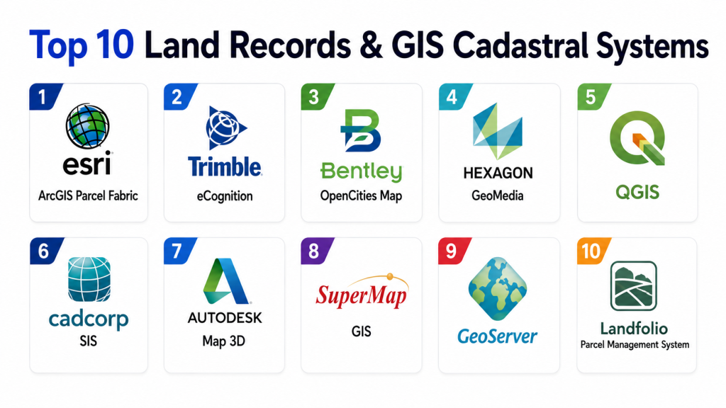
Top 10 Land Records and GIS Cadastral Systems
1- Esri ArcGIS Parcel Fabric
Esri ArcGIS Parcel Fabric is a GIS-enabled parcel management system for mapping, maintaining, and accessing land records across an organization. It extends ArcGIS Pro and ArcGIS Enterprise with a digitized land records system of record and tools for maintaining accurate parcel information. It is especially useful for government land agencies, municipalities, survey departments, and organizations already using ArcGIS for enterprise GIS. ArcGIS architecture materials also describe parcel management using enterprise geodatabases, forms, maps, structured relational data, and complex parcel fabric workflows.
Key Features
- Parcel fabric management
- GIS-based land record editing
- Parcel history tracking
- Boundary and geometry management
- Enterprise geodatabase support
- ArcGIS Pro editing workflows
- ArcGIS Enterprise integration
- Spatial analysis and visualization
- Map-based public and internal workflows
- Support for advanced parcel data models
Pros
- Strong GIS foundation
- Excellent fit for parcel mapping and cadastral editing
- Works well in enterprise GIS environments
- Strong visualization and spatial analytics
- Supports structured parcel data workflows
Cons
- Requires GIS expertise
- Licensing and implementation can be complex
- Best suited for agencies already committed to Esri ecosystem
- Configuration may take time for cadastral workflows
Platforms / Deployment
- ArcGIS Pro
- ArcGIS Enterprise
- Web GIS workflows
- Cloud, enterprise, or hybrid options may vary by setup
Security & Compliance
- Not publicly stated for every deployment
- Security depends on ArcGIS Enterprise, identity, hosting, and agency configuration
Integrations & Ecosystem
ArcGIS Parcel Fabric integrates strongly with the ArcGIS ecosystem, including enterprise GIS, web maps, dashboards, mobile apps, spatial databases, imagery layers, planning systems, and public-facing portals. It is a strong option when land records must connect with broader GIS operations.
Support & Community
- Strong vendor documentation
- Large GIS user community
- Partner ecosystem available
- Training and implementation support widely available
2- Trimble Land Administration
Trimble Land Administration supports fit-for-purpose land administration and cadastral data capture using geospatial technology. Trimble highlights the ability to accelerate capturing land rights and land parcels with GNSS-based systems, making it relevant for governments and development programs that need practical, scalable land documentation. It is especially useful where agencies need field data capture, surveying accuracy, and land rights documentation connected to broader geospatial workflows.
Key Features
- Land rights capture
- Parcel data collection
- GNSS-enabled field workflows
- Cadastral and boundary surveying support
- Fit-for-purpose land administration
- Survey data integration
- Mobile data collection support
- Boundary verification workflows
- Geospatial field accuracy tools
- Land documentation support
Pros
- Strong surveying and field data foundation
- Useful for large-scale parcel capture programs
- Good fit for land modernization projects
- Supports practical land rights documentation
Cons
- May require field hardware and survey workflow planning
- Not always a full land registry system by itself
- Implementation depends on agency methodology and data model
- Integration planning is important
Platforms / Deployment
- Geospatial field tools
- GNSS-enabled devices
- Land administration workflows
- Deployment varies by project and agency
Security & Compliance
- Not publicly stated in full detail
Integrations & Ecosystem
Trimble fits well where cadastral systems need accurate field data, GNSS collection, boundary capture, and survey workflows. It may be paired with GIS platforms, land registries, cadastral databases, and government land information systems.
Support & Community
- Vendor support available
- Geospatial partner ecosystem
- Training may be needed for field and survey teams
3- Thomson Reuters Aumentum
Thomson Reuters Aumentum is a land administration and property tax system used by government agencies to manage land records, property information, valuation, taxation, and public-sector revenue workflows. It is often considered where jurisdictions need a broader land and property administration environment rather than only parcel editing. Aumentum is useful for land offices, assessors, recorders, registrars, and tax agencies that need ownership, assessment, billing, and land record processes connected.
Key Features
- Land administration workflows
- Property record management
- Assessment and valuation support
- Tax administration capabilities
- Ownership and parcel record handling
- Document and transaction workflows
- Public-sector revenue support
- Case and process management
- Reporting and analytics
- Government agency configuration
Pros
- Strong fit for land records plus tax workflows
- Useful for government revenue agencies
- Supports broader property administration
- Good option where land and assessment data must connect
Cons
- May be more complex than GIS-only parcel tools
- GIS functionality may require integration with mapping platforms
- Implementation can be significant
- Pricing is not publicly standardized
Platforms / Deployment
- Enterprise government platform
- Deployment varies by jurisdiction
- Cloud, hosted, or agency-specific options may vary
Security & Compliance
- Not publicly stated in full detail
Integrations & Ecosystem
Aumentum can be useful where land administration must connect with valuation, taxation, billing, registration, public access, and agency workflows. It may integrate with GIS, document management, and government finance systems depending on implementation.
Support & Community
- Enterprise vendor support
- Government implementation resources
- Training and migration support likely required
4- Spatial Dimension Landfolio
Spatial Dimension Landfolio is a land management and land administration platform commonly associated with mineral rights, land rights, cadastre, permits, tenure, and land asset management. Spatial Dimension became the home of Landfolio after the acquisition from Trimble, making it relevant for agencies and organizations managing land-related rights and spatial records. It is a strong fit for governments, natural resource agencies, and organizations that manage land tenure, permits, and rights-based spatial information.
Key Features
- Land rights management
- Tenure and permit tracking
- Spatial land records
- Cadastre-related workflows
- Document and application management
- Rights lifecycle tracking
- Map-based land data visibility
- Government and natural resource workflows
- Reporting and search
- Configurable land administration processes
Pros
- Strong for rights, permits, and tenure workflows
- Useful for land and natural resource agencies
- Good fit for spatial land administration
- Supports structured land lifecycle processes
Cons
- May be specialized for rights-heavy environments
- Full cadastral editing may require GIS integration
- Implementation depends on use case
- Public pricing is not standardized
Platforms / Deployment
- Enterprise land administration platform
- Deployment varies by agency
- Web and spatial workflows may apply
Security & Compliance
- Not publicly stated in full detail
Integrations & Ecosystem
Landfolio is useful where spatial rights, permits, land assets, cadastral information, and official workflows must be connected. It may work alongside GIS, document management, revenue, and public-sector systems.
Support & Community
- Vendor support available
- Implementation support likely required
- Best for land agencies and resource-focused organizations
5- Bentley OpenCities Map
Bentley OpenCities Map supports geospatial mapping, infrastructure data, and engineering-grade GIS workflows. It is relevant for cadastral and land information environments where parcel data must connect with engineering, utility, infrastructure, and municipal mapping. It is particularly useful for agencies that need CAD-GIS integration, high-precision mapping, and infrastructure-aware land data management.
Key Features
- Geospatial mapping
- CAD-GIS integration
- Infrastructure data management
- Parcel and land base mapping
- Spatial editing workflows
- Utility and municipal mapping support
- 2D and 3D geospatial visualization
- Enterprise data management
- Engineering-grade spatial workflows
- Interoperability with design environments
Pros
- Strong engineering and infrastructure orientation
- Useful for municipalities and utilities
- Good CAD-GIS workflow support
- Can support high-precision land base mapping
Cons
- Not a dedicated land registry platform
- May require integration for legal land records
- Best suited for technical GIS and engineering teams
- Implementation can require specialized expertise
Platforms / Deployment
- Desktop and enterprise geospatial workflows
- Deployment varies by Bentley environment
- Integration with infrastructure systems may apply
Security & Compliance
- Not publicly stated in full detail
Integrations & Ecosystem
OpenCities Map fits environments where land parcels must connect with engineering drawings, infrastructure networks, utilities, city planning, and geospatial data management. It is strongest when used in technical municipal and infrastructure workflows.
Support & Community
- Vendor support available
- Bentley partner ecosystem
- Training recommended for technical teams
6- Autodesk AutoCAD Map 3D
Autodesk AutoCAD Map 3D combines CAD tools with GIS mapping features, making it useful for cadastral mapping, parcel drafting, utility mapping, and spatial data preparation. It is often used by surveyors, engineers, planners, and mapping teams that need to work with CAD-based parcel drawings while connecting to GIS data. It is not a complete land registry system, but it is a practical tool for preparing and maintaining spatial cadastral layers.
Key Features
- CAD-based mapping
- GIS data access
- Parcel drafting support
- Coordinate system handling
- Spatial data editing
- Map production
- Data cleanup tools
- Infrastructure mapping support
- Survey drawing workflows
- Integration with Autodesk ecosystem
Pros
- Familiar for CAD and survey teams
- Useful for parcel drafting and map maintenance
- Good fit for technical drawing workflows
- Supports GIS data connectivity
Cons
- Not a full land records system
- Requires integration with registry and database systems
- Less suitable as a public land administration portal
- Data governance must be handled separately
Platforms / Deployment
- Desktop software
- Autodesk ecosystem
- CAD and GIS workflow environment
Security & Compliance
- Not publicly stated in full detail
Integrations & Ecosystem
AutoCAD Map 3D works well with CAD drawings, GIS datasets, survey outputs, and infrastructure mapping workflows. It can be used alongside enterprise GIS, land records databases, and public-sector document systems.
Support & Community
- Strong Autodesk documentation
- Large CAD user community
- Training widely available
7- QGIS with Cadastre Plugins and PostGIS
QGIS with cadastre-focused plugins and PostGIS can provide an open-source foundation for land records mapping, cadastral visualization, parcel editing, and spatial data management. It is especially useful for agencies, municipalities, NGOs, and technical teams that need flexible GIS capabilities without proprietary licensing constraints. While QGIS is not a full land registry by itself, it can be combined with PostGIS databases, web maps, forms, and custom applications to build a practical cadastral system.
Key Features
- Open-source GIS mapping
- Parcel layer editing
- PostGIS spatial database support
- Custom forms and attributes
- Spatial analysis
- Map publishing workflows
- Plugin ecosystem
- Survey data import
- Public web map integration potential
- Custom cadastral workflows
Pros
- Flexible and cost-effective
- Strong open-source GIS ecosystem
- Useful for custom cadastral projects
- Works well with PostGIS and open standards
Cons
- Requires technical GIS and database expertise
- Not an out-of-the-box land registry system
- Support depends on internal teams or vendors
- Custom development may be needed
Platforms / Deployment
- Desktop GIS
- PostGIS database
- Web GIS extensions possible
- Open-source deployment
Security & Compliance
- Depends on system architecture and hosting
- Not publicly stated as a packaged compliance solution
Integrations & Ecosystem
QGIS and PostGIS can integrate with web mapping platforms, spatial databases, data collection tools, APIs, reporting systems, and custom land records applications. It is ideal where flexibility and customization are priorities.
Support & Community
- Large open-source community
- Documentation and forums available
- Commercial support available through partners
8- OpenG2P and Open Source Land Administration Stack
Open-source land administration stacks are increasingly used for digital public infrastructure, land record modernization, and fit-for-purpose land documentation. These systems can combine identity, registry, GIS, workflows, mobile data collection, public portals, and secure records to support land service delivery. They are most relevant for governments and development programs that want modular, interoperable, and locally adaptable land administration systems.
Key Features
- Modular land administration workflows
- Registry and service delivery components
- GIS integration potential
- Mobile data collection
- Citizen-facing services
- Open standards support
- Public digital infrastructure alignment
- Configurable forms and processes
- Data exchange workflows
- Custom government deployment
Pros
- Flexible and adaptable
- Useful for public-sector modernization
- Can reduce vendor lock-in
- Good fit for locally customized systems
Cons
- Requires strong implementation capacity
- Not a packaged cadastral product in every case
- Support depends on partners and project governance
- Long-term maintenance must be planned
Platforms / Deployment
- Open-source or modular architecture
- Cloud, government cloud, or on-premises options
- Deployment depends on system design
Security & Compliance
- Depends on architecture, hosting, and implementation controls
Integrations & Ecosystem
Open-source land administration stacks can connect with GIS, identity systems, payment systems, document repositories, registries, public portals, and analytics platforms. They work best where a government has clear architecture and implementation partners.
Support & Community
- Community and partner support varies
- Implementation support required
- Best for governments with digital public infrastructure strategy
9- NIC and State Land Records Portals
NIC-supported and state-level land record systems are widely used in India for online land records, mutation services, cadastral map access, and revenue department workflows. Examples include state portals that publish Record of Rights, mutation status, land records, and government land service information. Jharkhand’s Jharbhoomi portal, for example, displays mutation case statistics and land record services, while district pages link citizens to official land record services.
Key Features
- Online land record search
- Record of Rights access
- Mutation status tracking
- Revenue department workflows
- Cadastral map access in supported regions
- Citizen service portals
- Public land information
- Government service integration
- Local-language support may vary
- State-specific land administration workflows
Pros
- Official government land record access
- Useful for citizens, officials, and service centers
- Supports transparency and online services
- Strong relevance for India-focused land records
Cons
- Features vary by state
- User experience differs across portals
- Integration depth may vary
- Not a commercial off-the-shelf product
Platforms / Deployment
- Government web portals
- State-specific deployment
- Public and administrative workflows
Security & Compliance
- Government-controlled systems
- Security and access depend on state architecture and policies
Integrations & Ecosystem
State land record portals may connect with registration, revenue, survey, mutation, GIS map, and citizen service systems depending on the state. They are especially relevant for public access and government service delivery.
Support & Community
- Government help resources vary by state
- Local revenue office support may apply
- Citizen service centers may provide assistance
10- Manatron GRM and Land Records Systems
Manatron GRM and similar government records systems support property records, land records, tax, assessment, and local government workflows. These platforms are relevant where county, municipal, or regional governments need structured property data, records, public access, and revenue administration. They are not always pure GIS cadastral platforms, but they can work with GIS systems to connect parcel maps with assessment, ownership, tax, and record data.
Key Features
- Property record management
- Land record workflows
- Assessment support
- Tax and revenue data
- Public access support
- Document and transaction handling
- Reporting workflows
- Government record administration
- Parcel data linkage
- Agency process management
Pros
- Useful for local government property workflows
- Good fit for assessment and tax-linked records
- Can complement GIS parcel systems
- Supports public-sector records management
Cons
- May require GIS integration for advanced cadastral maps
- Not a full survey-grade parcel fabric system
- Implementation depends on agency needs
- Pricing and deployment vary
Platforms / Deployment
- Government records platform
- Deployment varies by jurisdiction
- Integration with GIS and tax systems may apply
Security & Compliance
- Not publicly stated in full detail
Integrations & Ecosystem
Manatron-style land records systems are useful where property records, ownership, assessment, tax, and public access must connect with GIS parcel layers and local government workflows.
Support & Community
- Vendor support available
- Public-sector implementation resources likely required
- Best for local government records and tax offices
Comparison Table
| Tool Name | Best For | Primary Focus | Deployment | Standout Feature | Public Rating |
|---|---|---|---|---|---|
| Esri ArcGIS Parcel Fabric | Government parcel management | GIS parcel fabric and cadastral editing | Enterprise GIS | Structured parcel history and editing | Varies / N/A |
| Trimble Land Administration | Field land rights capture | Survey and fit-for-purpose land administration | Project-based / field systems | GNSS-enabled parcel capture | Varies / N/A |
| Thomson Reuters Aumentum | Land and property administration | Land records, assessment, and tax | Enterprise government platform | Property administration workflows | Varies / N/A |
| Spatial Dimension Landfolio | Land rights and tenure management | Rights, permits, and spatial land records | Enterprise platform | Tenure and rights lifecycle tracking | Varies / N/A |
| Bentley OpenCities Map | Municipal and infrastructure GIS | CAD-GIS geospatial mapping | Desktop / enterprise | Engineering-grade geospatial workflows | Varies / N/A |
| Autodesk AutoCAD Map 3D | Survey and CAD-based mapping | CAD plus GIS parcel drafting | Desktop | Familiar CAD cadastral drafting | Varies / N/A |
| QGIS with PostGIS | Custom open-source cadastre | Open-source GIS and spatial database | Desktop / database / web | Flexible low-cost cadastral foundation | Varies / N/A |
| Open Source Land Administration Stack | Government digital modernization | Modular land service delivery | Custom / modular | Open and adaptable architecture | Varies / N/A |
| NIC and State Land Records Portals | India land record access | Public land records and mutation services | Government web portals | Official citizen-facing records | Varies / N/A |
| Manatron GRM and Land Records Systems | Local government property records | Property, tax, and land records | Government platform | Assessment and property record alignment | Varies / N/A |
Evaluation and Scoring Table
| Tool | Core 25 | Ease 15 | Integrations 15 | Security 10 | Performance 10 | Support 10 | Value 15 | Weighted Total |
|---|---|---|---|---|---|---|---|---|
| Esri ArcGIS Parcel Fabric | 9.5 | 7.8 | 9.2 | 8.8 | 9.0 | 9.0 | 8.3 | 8.84 |
| Trimble Land Administration | 8.8 | 8.0 | 8.5 | 8.0 | 8.8 | 8.5 | 8.4 | 8.45 |
| Thomson Reuters Aumentum | 9.0 | 7.5 | 8.8 | 8.6 | 8.6 | 8.5 | 8.0 | 8.45 |
| Spatial Dimension Landfolio | 8.7 | 7.8 | 8.5 | 8.2 | 8.4 | 8.3 | 8.0 | 8.29 |
| Bentley OpenCities Map | 8.3 | 7.6 | 8.6 | 8.0 | 8.7 | 8.3 | 7.9 | 8.20 |
| Autodesk AutoCAD Map 3D | 8.0 | 8.2 | 8.2 | 7.8 | 8.4 | 8.2 | 8.2 | 8.15 |
| QGIS with PostGIS | 8.2 | 7.4 | 8.6 | 7.8 | 8.5 | 7.6 | 9.0 | 8.19 |
| Open Source Land Administration Stack | 8.0 | 7.0 | 8.6 | 7.8 | 8.0 | 7.5 | 8.8 | 7.96 |
| NIC and State Land Records Portals | 8.4 | 7.8 | 8.0 | 8.0 | 8.2 | 7.8 | 9.0 | 8.20 |
| Manatron GRM and Land Records Systems | 8.3 | 7.8 | 8.2 | 8.2 | 8.2 | 8.2 | 8.0 | 8.14 |
Which Land Records and GIS Cadastral System Is Right for You?
Small Municipalities
Small municipalities should prioritize ease of use, parcel map maintenance, property records, and public access. QGIS with PostGIS can be a cost-effective option when the municipality has technical GIS support. AutoCAD Map 3D can work well for CAD-heavy survey and drafting teams. Manatron-style systems may be useful when property records and tax administration are the main focus.
Survey and Mapping Departments
Survey departments should focus on boundary accuracy, parcel editing, GNSS workflows, survey records, and geometry validation. Esri ArcGIS Parcel Fabric is strong for structured parcel management, while Trimble tools are useful for field capture and survey-grade workflows. AutoCAD Map 3D and Bentley OpenCities Map are also practical where CAD-GIS workflows are important.
Revenue and Land Registry Agencies
Revenue and land registry agencies need ownership records, mutation workflows, parcel maps, legal document management, historical record tracking, and public-service portals. Aumentum, ArcGIS Parcel Fabric, Landfolio, NIC-style systems, and open-source land administration stacks may fit depending on legal structure and government architecture.
Urban Planning and Infrastructure Teams
Planning and infrastructure teams need parcel data connected with zoning, land use, utilities, transport, environmental constraints, and development permissions. ArcGIS Parcel Fabric, Bentley OpenCities Map, AutoCAD Map 3D, and QGIS with PostGIS can support these workflows depending on existing technical systems.
National Land Modernization Programs
National or statewide programs need scalable architecture, data standards, field capture, public portals, audit controls, and integration with registration, tax, identity, courts, and planning systems. Esri, Trimble, Aumentum, Landfolio, open-source stacks, and government digital infrastructure platforms should be evaluated based on policy, scale, and implementation capacity.
Budget vs Premium
Budget-conscious agencies may use QGIS, PostGIS, open-source stacks, and locally built portals. Premium platforms like ArcGIS Parcel Fabric, Aumentum, Trimble solutions, Landfolio, and Bentley tools may provide stronger vendor support, enterprise capabilities, and mature workflows. The best choice depends on internal technical capacity and long-term maintenance planning.
Feature Depth vs Ease of Use
ArcGIS Parcel Fabric and Aumentum provide deep land administration capabilities but need trained teams. QGIS and AutoCAD Map 3D may be easier for technical mapping teams already familiar with those tools. Government portals may be easier for citizens, but harder for agencies if back-office systems are fragmented.
Integrations and Scalability
A strong land records platform should connect with land registration, revenue, property tax, survey, planning, valuation, courts, identity, document management, payment, and public service systems. Agencies should avoid isolated mapping tools when official land records require legal, financial, and citizen-service workflows.
Security and Compliance Needs
Land systems manage sensitive ownership, dispute, valuation, transaction, and government records. Buyers should review role-based access, audit logs, data change history, digital signatures, backup policies, public access controls, document retention, and legal validity of electronic records.
Implementation Playbook
First 30 Days
- Identify all current land record sources, including paper registers, maps, deeds, mutation records, tax rolls, survey files, and digital databases.
- Define the official system of record for ownership, parcel geometry, legal documents, and public display.
- Map workflows for mutation, subdivision, parcel merge, boundary correction, valuation change, and ownership transfer.
- Identify integrations with registration, taxation, planning, court, document management, and public portals.
- Select a pilot region or ward with manageable parcel volume.
- Define data standards for parcel IDs, owner names, land use codes, boundary attributes, and document references.
First 60 Days
- Digitize and clean parcel data for the pilot area.
- Reconcile ownership records with cadastral boundaries.
- Validate geometry for overlaps, gaps, duplicate IDs, and missing attributes.
- Configure user roles for surveyors, revenue officers, clerks, administrators, and public users.
- Test mutation, transfer, parcel split, parcel merge, and map update workflows.
- Build dashboards for pending mutations, disputed parcels, survey corrections, and data quality.
- Train staff on map editing, record update, document upload, and approval processes.
First 90 Days
- Expand from pilot parcels to additional villages, wards, zones, or municipalities.
- Launch citizen-facing services for search, map view, mutation status, or certificate access where legally approved.
- Integrate with tax, registration, and planning systems.
- Establish audit workflows for every change in parcel geometry or ownership record.
- Create backup, archival, and disaster recovery procedures.
- Review data quality issues and refine validation rules.
- Build a long-term governance model for updates, corrections, public feedback, and interdepartmental coordination.
Common Mistakes and How to Avoid Them
- Treating GIS maps and legal records separately: A cadastral system must connect spatial boundaries with official land records.
- Digitizing without cleaning data: Scanning maps is not enough; parcel IDs, owner records, boundaries, and documents must be reconciled.
- Ignoring historical records: Parcel splits, merges, transfers, and disputes need history to preserve legal traceability.
- Skipping field verification: Legacy maps may not match ground reality, especially in older settlements or informal areas.
- Using generic GIS without land workflows: Mapping tools need cadastral rules, parcel history, document linkage, and approval workflows.
- Not planning public access carefully: Citizen portals need clear rules for privacy, authenticity, downloadable records, and dispute handling.
- Weak integration with registration systems: Ownership changes must connect with registration and mutation workflows.
- No data governance model: Agencies need defined roles for who can edit maps, approve records, publish data, and resolve conflicts.
- Underestimating training: Revenue officials, surveyors, GIS staff, clerks, and administrators need different training.
- Ignoring legal validity: Digital records must align with land laws, evidence rules, and official notification procedures.
- Over-customizing early: Start with core workflows, then refine after pilot feedback.
- Not measuring outcomes: Track mutation time, dispute reduction, map accuracy, data completeness, and citizen service adoption.
Frequently Asked Questions
1- What is a Land Records and GIS Cadastral System?
A Land Records and GIS Cadastral System is software that connects legal land records with spatial parcel maps. It helps agencies manage ownership, parcel boundaries, mutations, survey records, documents, maps, and public land services in a structured digital environment.
2- What is the difference between land records and cadastre?
Land records usually focus on legal ownership, rights, transactions, and documents. Cadastre focuses on parcel boundaries, spatial location, measurements, and map-based property information. A modern system connects both.
3- Why is GIS important for land records?
GIS shows where parcels are located, how boundaries relate to nearby parcels, and how land connects with roads, utilities, zoning, environmental layers, and infrastructure. It turns land records into map-based intelligence.
4- What is a parcel fabric?
A parcel fabric is a structured GIS data model for managing land parcels, boundaries, legal records, and parcel history. It helps agencies maintain accurate parcel relationships and track changes such as splits, merges, and subdivisions.
5- Can open-source tools support cadastral systems?
Yes. QGIS, PostGIS, and custom open-source stacks can support cadastral mapping and land administration workflows. However, they require strong technical planning, data governance, security design, and implementation support.
6- What integrations are important for land records systems?
Important integrations include land registration, property tax, survey systems, document management, GIS portals, valuation systems, planning systems, courts, identity systems, payment platforms, and citizen service portals.
7- Are cadastral systems useful for property tax?
Yes. Accurate parcel data helps governments identify taxable properties, update ownership, calculate land use or valuation categories, reduce duplication, and improve revenue administration.
8- How do these systems reduce land disputes?
They reduce disputes by improving record accuracy, linking maps with ownership records, preserving parcel history, documenting changes, and making official information more transparent. However, legal and administrative processes are still needed for dispute resolution.
9- Should agencies choose cloud or on-premises deployment?
The right choice depends on government policy, data sensitivity, IT capacity, connectivity, scalability, and budget. Cloud can simplify access and updates, while on-premises or hybrid deployment may be preferred for sovereignty or regulatory reasons.
10- Which Land Records and GIS Cadastral System is best overall?
There is no single best system for every agency. ArcGIS Parcel Fabric is strong for GIS-based parcel management, Trimble is strong for field capture and fit-for-purpose land administration, Aumentum is strong for property administration, and QGIS with PostGIS is strong for flexible open-source cadastral projects.
Conclusion
Land Records and GIS Cadastral Systems are essential for building trusted, transparent, and efficient land administration. The right platform connects ownership records, parcel boundaries, survey data, mutation workflows, tax information, planning layers, documents, and public access into one reliable environment. ArcGIS Parcel Fabric is a strong choice for enterprise GIS parcel management, Trimble supports field-based land rights capture, Aumentum fits broader land and property administration, and QGIS with PostGIS can be powerful for open-source cadastral projects. Agencies should begin by mapping current records, cleaning parcel data, piloting one region, validating legal and spatial accuracy, and then scaling with strong governance. A successful land records modernization program improves citizen trust, reduces disputes, supports property taxation, and gives planners and administrators a dependable foundation for long-term development.