Introduction
3D scan and photogrammetry software enables users to convert real-world objects, environments, or images into accurate digital 3D models. These tools process data from photographs, drones, or laser scanners (LiDAR) to reconstruct geometry, textures, and spatial relationships.
This category has become essential as industries move toward digital twins, simulation environments, and reality capture workflows. Organizations can now digitize physical assets quickly, reduce manual measurement errors, and improve collaboration across design, engineering, and inspection processes.
Common Use Cases
- Creating 3D models from photos or scans
- Construction site documentation and surveying
- Cultural heritage preservation
- Gaming and VFX asset creation
- Reverse engineering and industrial inspection
What Buyers Should Evaluate
- Reconstruction accuracy and resolution
- Input support (images, drones, LiDAR)
- Processing speed and scalability
- Ease of use and automation features
- Output formats (mesh, point cloud, CAD-ready files)
- Integration with CAD, BIM, and GIS tools
- Cloud vs local processing
- Hardware requirements
- Collaboration capabilities
- Security and data control
Best for: Surveyors, architects, engineers, VFX artists, drone operators, and enterprises building digital twins or working with real-world capture.
Not ideal for: Users focused purely on manual 3D modeling or those without access to imaging or scanning hardware.
Key Trends in 3D Scan & Photogrammetry Software
- AI-powered reconstruction: Automated alignment, mesh cleanup, and object detection
- Mobile LiDAR adoption: Smartphones enabling fast, on-site scanning
- Cloud photogrammetry pipelines: Offloading heavy processing to remote servers
- Real-time reconstruction feedback: Immediate validation during capture
- Drone-first workflows: Scalable aerial mapping and surveying solutions
- Digital twin integration: Linking scan data with simulation systems
- Automation of mesh optimization: Reduced manual post-processing
- Cross-platform interoperability: Seamless export to CAD, BIM, and game engines
- Hybrid workflows: Combining desktop precision with cloud scalability
- Expansion into enterprise use cases: Construction, infrastructure, and healthcare
How We Selected These Tools (Methodology)
- Evaluated market adoption and industry credibility
- Assessed accuracy and reconstruction quality
- Reviewed processing performance and scalability
- Considered ease of use vs advanced control
- Analyzed input compatibility (photos, drones, LiDAR)
- Evaluated integration with CAD, BIM, and GIS systems
- Considered deployment flexibility (cloud vs local)
- Reviewed community support and documentation
- Included tools for different user segments (beginner → enterprise)
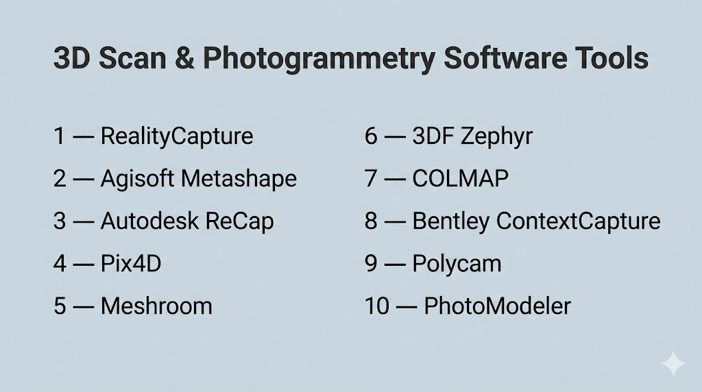
Top 10 3D Scan & Photogrammetry Software Tools
#1 — RealityCapture
Short description: A high-performance photogrammetry tool designed for fast, accurate reconstruction from images and LiDAR data.
Key Features
- High-speed image alignment and reconstruction
- LiDAR and photogrammetry integration
- Large dataset processing
- Advanced mesh and texture generation
- Georeferencing and measurement tools
- Automated workflows
Pros
- Extremely fast processing engine
- High-quality, detailed outputs
Cons
- Requires powerful hardware
- Complex for beginners
Platforms / Deployment
- Windows
- Self-hosted
Security & Compliance
- Not publicly stated
Integrations & Ecosystem
- CAD tools
- Game engines
- GIS systems
- Export formats and APIs
Support & Community
Strong professional community and documentation.
#2 — Agisoft Metashape
Short description: A widely used photogrammetry tool for generating accurate 3D models, orthomosaics, and point clouds from images.
Key Features
- Dense point cloud generation
- Orthomosaic and DEM creation
- Batch processing workflows
- Scriptable automation
- Multi-platform support
- Customizable reconstruction pipeline
Pros
- High accuracy and flexibility
- Cross-platform compatibility
Cons
- Resource-intensive
- Slower than some competitors
Platforms / Deployment
- Windows / macOS / Linux
- Self-hosted
Security & Compliance
- Not publicly stated
Integrations & Ecosystem
- GIS tools
- CAD workflows
- Export formats
- Python scripting
Support & Community
Large user base in research, surveying, and mapping.
#3 — Autodesk ReCap
Short description: A reality capture tool for converting laser scans and photos into 3D models for design and BIM workflows.
Key Features
- LiDAR and photo processing
- Point cloud editing
- Measurement and analysis tools
- Cloud storage integration
- BIM-ready outputs
Pros
- Strong integration with design workflows
- User-friendly interface
Cons
- Subscription-based
- Limited advanced customization
Platforms / Deployment
- Windows
- Cloud / Self-hosted
Security & Compliance
- Not publicly stated
Integrations & Ecosystem
- Autodesk ecosystem
- BIM tools
- CAD systems
Support & Community
Well-documented with enterprise support.
#4 — Pix4D
Short description: A professional photogrammetry platform optimized for drone mapping and large-scale surveying.
Key Features
- Drone and aerial image processing
- 3D mesh and point cloud generation
- GIS integration
- Cloud and mobile workflows
- Multi-spectral image support
Pros
- Industry-standard for mapping
- Supports multiple input types
Cons
- Expensive
- Complex workflows
Platforms / Deployment
- Windows / macOS / Linux
- Cloud / Self-hosted
Security & Compliance
- Not publicly stated
Integrations & Ecosystem
- Drone platforms
- GIS tools
- CAD workflows
- Mobile capture apps
Support & Community
Strong professional ecosystem.
#5 — Meshroom
Short description: An open-source photogrammetry tool using node-based workflows for customizable reconstruction.
Key Features
- Node-based processing pipeline
- Image-based reconstruction
- GPU acceleration
- Customizable workflows
- Open-source flexibility
Pros
- Free and extensible
- Flexible processing
Cons
- Technical setup required
- Limited official support
Platforms / Deployment
- Windows / Linux
- Self-hosted
Security & Compliance
- Not publicly stated
Integrations & Ecosystem
- Open-source tools
- Custom pipelines
- Export formats
Support & Community
Community-driven support and forums.
#6 — 3DF Zephyr
Short description: A photogrammetry suite offering automated workflows for generating textured 3D models.
Key Features
- Automated reconstruction
- Dense point cloud generation
- Mesh editing tools
- Texture mapping
- Multi-camera support
Pros
- User-friendly interface
- Multiple pricing tiers
Cons
- Limited deep customization
- Performance varies with dataset size
Platforms / Deployment
- Windows
- Self-hosted
Security & Compliance
- Not publicly stated
Integrations & Ecosystem
- CAD tools
- Export formats
- Plugins
Support & Community
Growing user base.
#7 — COLMAP
Short description: A research-grade photogrammetry pipeline for accurate 3D reconstruction.
Key Features
- Structure-from-Motion algorithms
- Multi-view stereo reconstruction
- Sparse and dense modeling
- Command-line and GUI tools
- High accuracy outputs
Pros
- Highly accurate
- Free
Cons
- Not beginner-friendly
- Requires technical knowledge
Platforms / Deployment
- Windows / macOS / Linux
- Self-hosted
Security & Compliance
- Not publicly stated
Integrations & Ecosystem
- Research tools
- Export formats
- Custom pipelines
Support & Community
Strong academic community.
#8 — Bentley ContextCapture
Short description: An enterprise-grade solution for large-scale infrastructure and city modeling.
Key Features
- Large-scale photogrammetry
- High-resolution reality meshes
- Automation tools
- Infrastructure modeling
- Cloud processing
Pros
- Scales to massive datasets
- High accuracy
Cons
- Expensive
- Complex setup
Platforms / Deployment
- Windows
- Cloud / Self-hosted
Security & Compliance
- Not publicly stated
Integrations & Ecosystem
- BIM tools
- Infrastructure platforms
- CAD systems
Support & Community
Enterprise-grade support.
#9 — Polycam
Short description: A mobile-first 3D scanning tool using smartphone cameras and LiDAR.
Key Features
- Mobile scanning
- LiDAR support
- Real-time capture
- Cloud processing
- Easy export
Pros
- Very easy to use
- Portable and accessible
Cons
- Lower precision than professional tools
- Device-dependent performance
Platforms / Deployment
- iOS / Android / Web
- Cloud
Security & Compliance
- Not publicly stated
Integrations & Ecosystem
- Cloud storage
- Export formats
- Mobile workflows
Support & Community
Popular among mobile creators.
#10 — PhotoModeler
Short description: A photogrammetry tool focused on measurement accuracy and engineering workflows.
Key Features
- Image-based measurement
- CAD integration
- Point cloud generation
- Precision modeling
- Automation tools
Pros
- High measurement accuracy
- Strong engineering use case
Cons
- Less suited for creative workflows
- Learning curve
Platforms / Deployment
- Windows
- Self-hosted
Security & Compliance
- Not publicly stated
Integrations & Ecosystem
- CAD tools
- Engineering workflows
- Export formats
Support & Community
Niche but professional community.
Comparison Table (Top 10)
| Tool Name | Best For | Platform(s) Supported | Deployment | Standout Feature | Public Rating |
|---|---|---|---|---|---|
| RealityCapture | Speed & accuracy | Windows | Self-hosted | Fast reconstruction | N/A |
| Metashape | Accuracy | Cross-platform | Self-hosted | Flexible pipeline | N/A |
| ReCap | BIM workflows | Windows | Hybrid | Autodesk integration | N/A |
| Pix4D | Drone mapping | Cross-platform | Hybrid | GIS integration | N/A |
| Meshroom | Open-source | Win/Linux | Self-hosted | Node-based workflows | N/A |
| 3DF Zephyr | Automation | Windows | Self-hosted | Easy workflows | N/A |
| COLMAP | Research | Cross-platform | Self-hosted | Advanced algorithms | N/A |
| ContextCapture | Enterprise | Windows | Hybrid | Large-scale modeling | N/A |
| Polycam | Mobile scanning | iOS/Android/Web | Cloud | Portable capture | N/A |
| PhotoModeler | Engineering | Windows | Self-hosted | Measurement accuracy | N/A |
Evaluation & Scoring of 3D Scan & Photogrammetry Software
| Tool Name | Core (25%) | Ease (15%) | Integrations (15%) | Security (10%) | Performance (10%) | Support (10%) | Value (15%) | Weighted Total |
|---|---|---|---|---|---|---|---|---|
| RealityCapture | 10 | 6 | 8 | 6 | 10 | 8 | 7 | 8.4 |
| Metashape | 9 | 7 | 8 | 6 | 8 | 8 | 7 | 8.0 |
| ReCap | 8 | 8 | 9 | 6 | 8 | 8 | 7 | 8.0 |
| Pix4D | 9 | 6 | 9 | 6 | 9 | 8 | 6 | 8.2 |
| Meshroom | 8 | 5 | 7 | 5 | 7 | 7 | 10 | 7.6 |
| Zephyr | 8 | 8 | 7 | 5 | 8 | 7 | 7 | 7.7 |
| COLMAP | 9 | 4 | 7 | 5 | 9 | 7 | 10 | 7.9 |
| ContextCapture | 10 | 5 | 9 | 6 | 10 | 8 | 5 | 8.2 |
| Polycam | 7 | 9 | 6 | 5 | 7 | 7 | 8 | 7.5 |
| PhotoModeler | 8 | 6 | 8 | 5 | 8 | 7 | 7 | 7.6 |
How to interpret:
- Scores are relative comparisons across tools
- Higher scores indicate better balance across criteria
- Specialized tools may score lower in ease but higher in core features
- Value reflects cost vs capabilities
- Use this table for shortlisting, not absolute ranking
Which 3D Scan & Photogrammetry Tool Is Right for You?
Solo / Freelancer
- Best options: Meshroom, Polycam
- Focus on affordability and simplicity
SMB
- Best options: Metashape, 3DF Zephyr
- Balance between usability and capability
Mid-Market
- Best options: Pix4D, ReCap
- Require accuracy and integrations
Enterprise
- Best options: RealityCapture, ContextCapture
- Need scalability and large dataset support
Budget vs Premium
- Budget: Meshroom, COLMAP
- Premium: Pix4D, RealityCapture
Feature Depth vs Ease of Use
- Deep tools: RealityCapture, Pix4D
- Easy tools: Polycam, Zephyr
Integrations & Scalability
- Strong ecosystems: ReCap, ContextCapture
Security & Compliance Needs
- Most tools: Not publicly stated
- Enterprises should validate internally
Frequently Asked Questions (FAQs)
What is photogrammetry software?
It converts images into 3D models using multiple viewpoints and algorithms.
What is 3D scanning software?
It processes data from sensors like LiDAR to create 3D models.
Do I need a drone?
Not always—many tools work with regular photos or mobile devices.
Which tool is best for beginners?
Polycam and Meshroom are good starting points.
Is photogrammetry accurate?
Yes, accuracy depends on image quality and processing settings.
Can I use a smartphone?
Yes, many tools support mobile scanning and LiDAR.
Is cloud processing better?
Cloud is faster and scalable; local offers more control.
What industries use these tools?
Construction, gaming, film, surveying, and manufacturing.
Are there free tools available?
Yes, Meshroom and COLMAP are free.
What should I avoid when choosing?
Avoid tools that don’t support your input method (drone, LiDAR, images).
Conclusion
3D scan and photogrammetry software bridges the gap between the physical and digital worlds. From mobile apps to enterprise-grade platforms, these tools enable accurate and scalable reality capture workflows.